Garmin VEU722L Europe Atlantic Coast BlueChart® g3 Vision®
Rated 3/5
based on 1 customer reviews
by Joitos.com,
Be the first one to review this product.
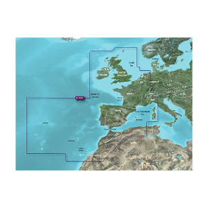
p strong VEU722L Europe Atlantic Coast BlueChart reg g3 Vision reg strong p p Detailed coverage of the Atlantic and Mediterranean coast of Western Europe the British Isles and northwestern Africa Coverage includes the Azores Canary Balearic Channel and Shetland Islands Sardinia Corsica and Madeira the western Mediterranean Sea from La Spezia IT to the Strait of Gibraltar Bay of Biscay English Channel Irish Sea Waddenzee IJsselmeer the inland canals and waterways of France and Benelux the Garonne Loire Seine and Rhone River systems the Rhine River to Neuwied DE Lake Leman Geneva the entire British Isles including Lough Neagh the Caledonian Canal the Isles of Wight and Man and the Thames River and Estuary the coast of Africa from Cape Bojador EH to Cape Bougaroun DZ p p strong Premier Coastal Charts strong p ul li Industry-leading coverage clarity and detail with updated coastal charts that feature integrated Garmin and Navionics reg content li li Auto Guidance sup1 technology quickly calculates a suggested route by using your desired depth and overhead clearance li li Includes Depth Range Shading for up to 10 depth ranges enabling you to view your target depth at a glance li li Up to 1 rsquo contours provide a more accurate depiction of the bottom structure for improved fishing charts li li To give a clear picture of shallow waters to avoid the Shallow Water Shading allows for shading at a user-defined depth li ul p Experience unparalleled coverage and brilliant detail when you rsquo re on the water BlueChart g3 Vision coastal charts provide industry-leading coverage clarity and detail with integrated Garmin and Navionics content p p img src https productimageserver com prop65 6pt png alt Warning strong WARNING strong This product can expose you to chemicals which are known to the State of California to cause cancer birth defects or other reproductive harm For more information go to a href P65Warnings ca gov P65Warnings ca gov a p --- cis2 mmxtmJVt --- br
No Reviews Yet